
Copernicus satellite images of Iran war region delayed after US request
The EU is holding some Sentinel images for 24 hours, slowing public monitoring of Gulf shipping lanes near the Strait of Hormuz.
By Hana Yoshida · Markets Reporter
3 min read
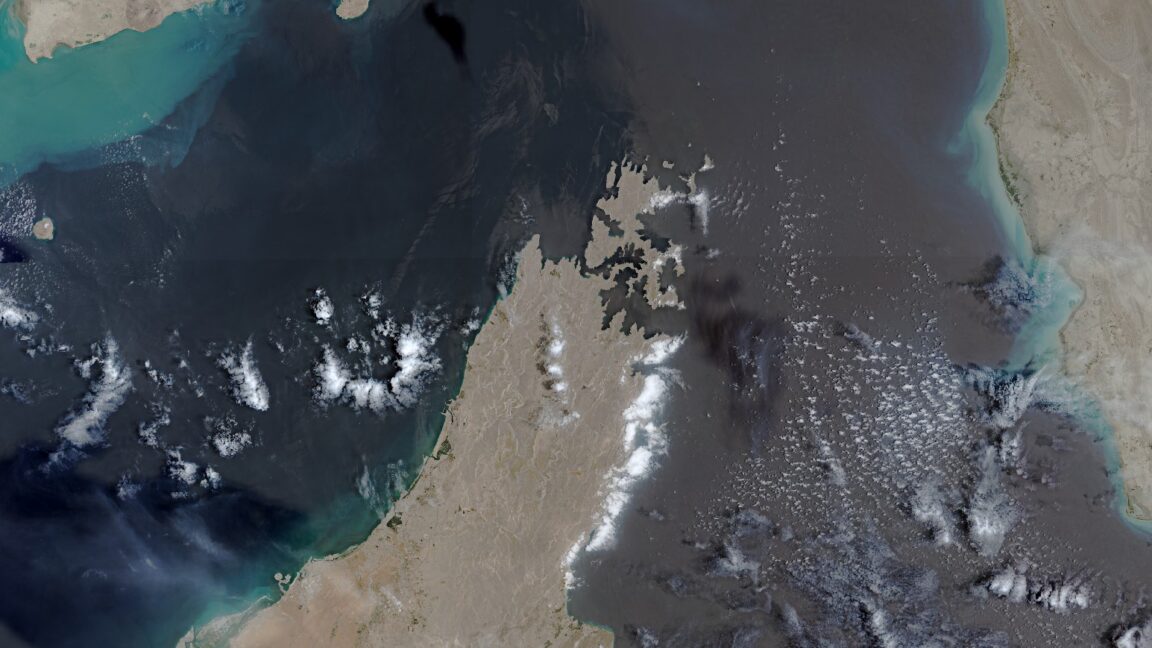
The European Union has begun delaying some Copernicus satellite images of Iran war-related shipping routes by 24 hours, SpaceNews reported, citing a Council of the EU decision dated July 13. The change affects public access to images of the Gulf of Oman, including lanes leading to and from the Strait of Hormuz.
SpaceNews reported that the delay was adopted after a U.S. government request made on May 26. The restriction applies to imagery from the Sentinel-1 and Sentinel-2 satellites, which are part of Europe’s Copernicus Earth observation program.
Copernicus is the EU’s Earth observation system, and its Sentinel missions collect data used for environmental monitoring, disaster response, shipping analysis and conflict research. Its open-data model has made it a key public alternative when commercial imagery is unavailable or delayed.
Why are Copernicus satellite images of Iran delayed?
The Council decision reviewed by SpaceNews links the new delay to the U.S. request to restrict imagery over the Gulf of Oman. The area is strategically sensitive because it covers maritime routes tied to the Strait of Hormuz, a contested chokepoint for global energy shipments.
The request came during a ceasefire period in the Iran war that began April 8 and ended July 8, according to reporting cited by Ars Technica. The U.S. military resumed a wider campaign of strikes after an announcement by President Donald Trump, Ars Technica reported.
The war began on February 28 with U.S. and Israeli attacks on Iran, according to the same reporting. Satellite data has played a central role for governments, newsrooms and open-source researchers tracking military activity and damage.
U.S. military and intelligence agencies have used satellite systems to monitor Iranian activity during the conflict, Ars Technica reported. The Economist has reported that Iran has used Chinese satellite imagery to aid attacks on U.S. military bases and other targets.
How the delay affects journalists and researchers
The 24-hour hold does not block access to the Copernicus images. It does, however, slow efforts by journalists and researchers who use near-current imagery to verify damage, track movements and check official claims.
Commercial access has already narrowed. Reuters reported that Planet Labs withheld Iran war imagery after U.S. officials raised security concerns, and Ars Technica reported that U.S. firms including Planet Labs and Vantor have restricted some imagery tied to the conflict.
Those limits have pushed researchers toward European and public data sources. Bellingcat released an open-source tool using Sentinel-1 imagery to help assess possible war damage in Iran and the Gulf region.
The New York Times and The Washington Post have also used Copernicus imagery in investigations of damage to U.S. military bases and radar sites from Iranian missile and drone attacks. Their reporting has come as the Pentagon under the Trump administration has provided less information on U.S. casualties and damage to military assets, according to The New York Times and Ars Technica.
The delay comes as the conflict has strained global energy markets through disruptions around the Strait of Hormuz, CNBC reported. The New York Times reported that the war had cost the United States more than $37 billion, with Defense Secretary Pete Hegseth seeking another $70 billion.
This story draws on original reporting from Ars Technica.