Copernicus Browser wildfire layer adds easier fire imagery analysis
Copernicus Browser has added a default Sentinel-2 wildfire view, making fire scars and active burning areas easier to read.
By Maya Lindqvist · Senior Technology Correspondent
3 min read
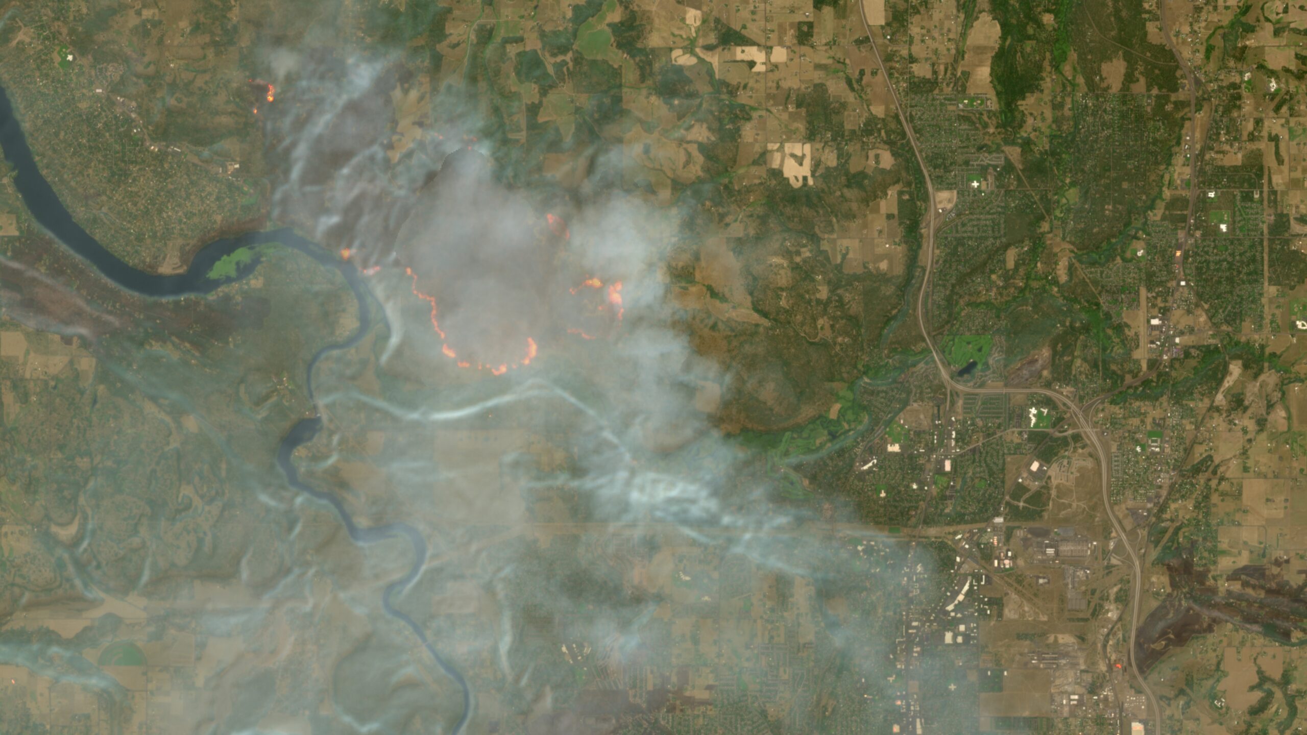
The Copernicus Browser wildfire layer has been added as a default viewing option for Sentinel-2 satellite imagery, according to Ars Technica. The change matters because it removes the need for users to load a custom script before they can more readily distinguish active fires, damaged vegetation and burn scars in the images.
Ars Technica reported that the feature went live on August 4 in Copernicus Browser, the free interface for recent imagery from the European Union's Copernicus Earth-observation programme. The update improves interpretation of images; it does not make Sentinel-2 collect images more often.
How does the Copernicus Browser wildfire layer work?
The layer assigns colors intended to separate fire-related features. Active fires show as white or yellow, vegetation that is burning appears red, and burned ground appears dark brown or black, according to Ars Technica.
The view grew out of a JavaScript visualization created by remote-sensing specialist Pierre Markuse, Ars Technica reported. Before the integration, Browser users could paste the code into the service's custom-visualization tool themselves.
The script combines red visible-light data with narrow near-infrared and short-wave infrared 2 bands. Ars Technica said that combination helps reveal differences between healthy and burned vegetation and moisture-related differences that can make burned areas clearer.
How current is the imagery?
Sentinel-2 can provide spatial resolution down to 10 meters in certain bands, but its imagery is refreshed every few days, Ars Technica reported. That gives the Browser finer spatial detail than NASA's FIRMS in the cited comparison, while limiting its use for following rapidly changing conditions.
FIRMS provides a global map of fires detected by NASA sensors and is updated within several hours, according to Ars Technica, though its cited imagery resolution reaches 250 meters. DW reported that NASA makes global FIRMS data public within three hours of an observation, with some data for the United States and Canada available in real time.
For readers, the split is practical: the new Browser layer can help with detailed visual assessment of a fire area when a Sentinel-2 image is available, while FIRMS offers more timely active-fire information at lower detail. Neither timing profile means people in affected areas should substitute satellite imagery for official emergency instructions.
Is Copernicus Browser the same as EFFIS?
No. The European Forest Fire Information System, or EFFIS, is a separate component of Copernicus Emergency Management Services, according to EFFIS. It supports agencies protecting forests in the EU and neighboring countries and offers tools including a current-situation viewer, statistics portal, fire-weather forecasts and a wildfire-risk viewer.
EFFIS says its current-situation viewer supplies up-to-date information on the fire season across Europe and the Mediterranean. It also cautions that mapped fires can include intentional vegetation-management burns, a distinction users should keep in mind when reading fire data.
This story draws on original reporting from Ars Technica.