
Robot helps scientists hunt for heat-tolerant coral reefs
Researchers are testing new tools in the Marshall Islands to find reefs that may survive warming seas and help replenish damaged coral ecosystems.
By Hana Yoshida · Markets Reporter
4 min read
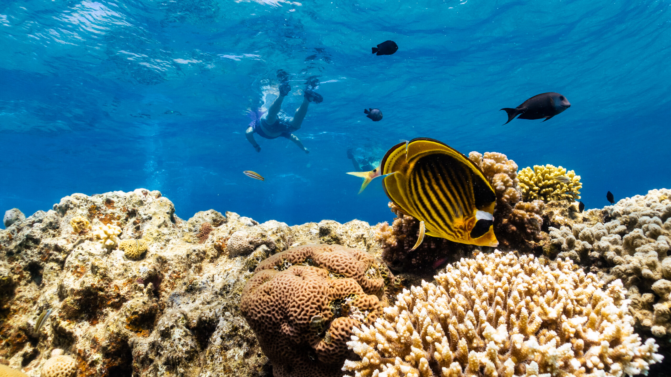
Researchers in the Marshall Islands are using an unmanned surface vessel to map reefs that appear able to withstand extreme ocean heat, part of an effort to protect coral communities that could help replenish damaged areas. The work comes as NOAA’s Coral Reef Watch says a global bleaching event that began in 2023 has affected more than 80 percent of reefs in at least 83 countries and territories.
Anne Cohen, a coral researcher at the Woods Hole Oceanographic Institution, is leading the work through the Super Reefs initiative, a project she began in 2018 to identify reefs that continue to thrive during heat stress. Cohen has focused recent fieldwork on Majuro, the capital atoll of the Marshall Islands, where some reefs inside the lagoon have shown unusual resilience.
Finding reefs that can seed recovery
Coral bleaching happens when heat-stressed corals lose the algae that live in their tissues and provide food and color, according to NOAA. Many reefs have failed to recover from recent marine heat waves, while Cohen’s team is searching for places where corals have either adapted to hotter water or benefit from local conditions that reduce heat stress.
In 2021, Cohen launched a broader Super Reefs effort with The Nature Conservancy and Stanford University to identify heat-tolerant reefs and help protect them. Lizzie McLeod, global ocean director at The Nature Conservancy, said protecting such reefs from pollution, dredging and other local damage could preserve heat-resistant corals while global warming is addressed.
The Marshall Islands are central to that strategy because coral underpins both the country’s geography and its food systems. Cohen said the sand and land of the atolls are made from coral, while Dua Rudolph, deputy director of the Marshall Islands Conservation Society, said many Marshallese people depend on reef fish for food or income.
Climate risks are already acute. A 2021 World Bank analysis found that rising seas threaten 40 percent of existing buildings in Majuro, including several schools. Anthony M. Muller, the Marshall Islands’ minister of natural resources and commerce, said the country is among the first exposed to sea-level rise.
A hotter site near Laura
To narrow the search, Cohen worked with Woods Hole oceanographers Weifeng Zhang and Yan Jia on a model of Majuro lagoon temperatures, currents and wave energy. The team looked for the hottest waters, reasoning that corals surviving there would be strong candidates for heat tolerance.
Temperature loggers and current sensors deployed by the Marshall Islands Conservation Society pointed to a reef near Laura, a community on Majuro’s southwestern edge. Cohen said water there appeared to run nearly two degrees hotter than much of the capital’s surrounding waters.
Rudolph’s team collected coral samples from several sites, and Stanford researchers tested the fragments in a dockside lab using picnic coolers, aquarium heaters, chillers and temperature controllers. Stephen Palumbi, who oversees Stanford’s coral recovery program at Hopkins Marine Station, said the tests showed which corals bleached quickly and which endured controlled heat exposure. Some of the strongest samples came from Laura, matching Cohen’s model.
The findings have been shared with Laura residents as local groups consider a community-managed marine area. Alicia Edwards of the Marshall Islands Marine Resources Authority said the Reimaanlok process, a Marshallese conservation framework meaning “looking to the future,” is designed to keep protection decisions community-led and culturally appropriate.
Support is not automatic. Rudolph said some local leaders were wary because the site is a common fishing ground in a community of about 900 people, most of them fishers. Jina David, a local councilman backing protection, said anchors and nighttime fishing on the reef can damage fragile corals, and he expects consensus could take at least two years.
Yellowfin speeds up the search
Cohen is also testing a yellow unmanned vessel called Yellowfin, adapted by Woods Hole engineer Peter Traykovski with a camera mounted beneath its hull. Cohen said the robot can photograph about 40 miles of reef in a day and collect up to 20,000 images, far beyond what divers could cover with conventional surveys.
Each image is tied to GPS coordinates, allowing researchers to revisit the same reef sections and compare bleaching, death and recovery over time. Cohen’s lab is training AI systems to analyze the images and is also building three-dimensional reef models to study whether a coral colony’s depth, angle or position affects its heat exposure.
Cohen said the aim is to expand the search across the Pacific, including a proposed “super reef blue corridor” linking the Marshall Islands, Kiribati and Tuvalu through reefs connected by ocean currents. Her team’s premise is that if the most resilient reefs are found and protected, their larvae could help seed future recovery across wider reef systems.
This story draws on original reporting from Ars Technica.