
Satellites help track toxic algae risk at Blue Mesa Reservoir
NASA says satellite and field data link Blue Mesa blooms to low water, warm temperatures and renewed drought risk in 2026.
By Lucas Ferreira · Science & Environment Writer
3 min read
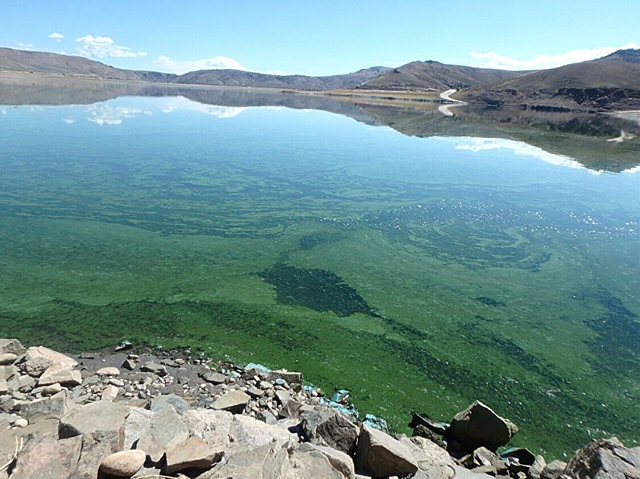
Satellite records are helping scientists identify when toxic cyanobacteria blooms are likely to flare at Colorado’s Blue Mesa Reservoir, NASA reported. The work matters for public health and recreation because some blooms can produce microcystin, a toxin associated with skin and eye irritation, breathing problems and liver damage, according to NASA.
The findings come after difficult summers in 2021 and 2022, when severe drought affected much of the western United States, NASA said. Emergency water releases pushed Blue Mesa to its lowest level since 1984, marinas and boat ramps closed, and green blooms appeared in parts of the reservoir, according to NASA.
Low water and warm temperatures raise risk
Research by the U.S. Geological Survey and the National Park Service found that harmful blooms at Blue Mesa were tied to low reservoir levels and warm water, NASA said. Tyler King, a USGS research hydrologist, said blooms were more frequent when the reservoir sat below 7,470 feet and water temperatures exceeded about 19.5 degrees Celsius, or 67.1 degrees Fahrenheit.
King said water levels below that threshold have occurred every few years in recent decades, according to NASA. The study drew on field samples, historical measurements and satellite observations to examine conditions over time.
NASA said cyanobacteria, often called blue-green algae, can exist in the reservoir at low concentrations. Problems develop when types such as Aphanizomenon, Dolichospermum and Woronichinia grow rapidly in warm, still water and produce microcystin, according to NASA. Children and pets face greater risk because of their size and because they are more likely to swallow water, NASA said.
Satellites show where blooms begin
King and other researchers used observations from the European Space Agency’s Sentinel-2 mission and NASA-USGS Landsat satellites, NASA said. Sentinel-2 measurements of chlorophyll, a light-harvesting pigment, helped map bloom locations, while Landsat data helped track water temperatures across time, according to NASA.
The National Park Service and USGS began the project in 2021 after reports and water samples pointed to elevated cyanobacteria levels, King said, according to NASA. Researchers also used older data to assess conditions before routine water sampling began. NASA said the analysis included satellite chlorophyll records back to 2016, temperature records back to 2000 and water-level measurements dating to the 1970s.
The satellite data showed blooms usually formed at the reservoir’s eastern end, in Iola Basin, NASA said. That area, where the Gunnison River enters Blue Mesa, is the reservoir’s shallowest section. NASA said blooms sometimes spread westward, reaching about two-thirds across the reservoir, though toxin levels seldom reached health-concern thresholds outside Iola Basin.
2026 conditions are again concerning
King said the same factors seen during the 2021 and 2022 bloom years are present in 2026, according to NASA. Drought is again affecting much of the West, mountain snow is limited and Blue Mesa water levels are low, NASA reported.
On June 27, 2026, Blue Mesa held about 43% of the water it typically stores on that date, the lowest level recorded for that day in the past 30 years, according to NASA. U.S. Bureau of Reclamation projections cited by NASA show the reservoir is expected to keep dropping until October.
If blooms appear this year, NASA said researchers expect satellites to help guide monitoring. The USGS WaterMAP tool can flag possible bloom conditions within hours of satellite passes, while NASA’s STREAM project uses Landsat and Sentinel-2 data to map possible blooms on a similar timetable, according to NASA. The multi-agency CyAN project uses daily observations from other satellites to track blooms in larger water bodies.
King said satellites can point scientists toward places that need closer attention, but field testing remains needed, according to NASA. He said satellite data cannot confirm toxins on its own because toxins often appear later in a bloom’s development.
This story draws on original reporting from Phys.org.