
Seafloor spreading near Antarctic plate unfolded in a six-day burst
A Nature study says instruments captured decades’ worth of ocean-crust extension at a remote ridge in April 2024.
By Hana Yoshida · Markets Reporter
3 min read
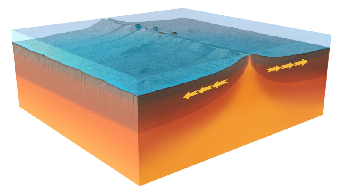
A seafloor monitoring network recorded a rapid burst of crust formation along the boundary between the Australian and Antarctic plates, according to a study published in Nature. The observations matter because they show mid-ocean ridges may produce new crust through short, intense episodes that seismic monitoring alone can miss.
The event occurred in April 2024 at a remote rift crossing the Amsterdam–Saint Paul Plateau, a seafloor rise roughly between Australia and Madagascar and south of India. The research team, made up of French scientists, had placed instruments on the ocean floor only about two months before the activity began, the study reports.
Mid-ocean ridges create new crust as plates move apart, a process central to plate tectonics. Scientists know the shape and structure of crust formed at these ridges from decades of surveys, but the Nature paper says direct observations of the formation process have been limited.
Instruments caught the ridge in motion
The monitoring array included hydrophones to locate seismic events and acoustic transmitters to measure changes in distance between stations, according to the researchers. Later visits by French supply and research ships allowed the team to map the seafloor in three dimensions and compare it with earlier surveys.
Previous work in the area found that spreading averages a little more than 60 millimeters per year, the study says. The rift sits in a roughly 2,000-meter-deep central depression bordered by rugged ridges.
When the April 2024 event began, the first seismic cluster moved south along the spreading zone, ending more than 8 kilometers from where it started, according to the Nature study. A second sequence then moved north across about 9 kilometers.
The researchers interpret that pattern as the formation of dykes, long, thin bodies created when molten rock forces its way into cracks. At the same time, instruments in the central valley began dropping, the study says.
That subsidence sped up while the dyke-related events continued, reaching about 5 centimeters per minute before slowing, according to the researchers. In all, the instruments sank 4.2 meters over six days.
New material appeared on the seafloor
The team links the sinking to drainage from a magma reservoir beneath the ridge. Nearby instruments also recorded rising water temperatures, which the researchers say is consistent with magma interacting with seawater.
Stations on opposite sides of the valley also moved apart during the episode, in some cases by well over a meter, according to the paper. After activity returned to background levels, a later vessel survey found areas more than 90 meters higher than in previous mapping, beyond the expected measurement error.
One new patch of material was more than 4 kilometers long, the researchers report. They estimate that the event added about 150 million cubic meters of material to the seafloor.
To connect the observations, the team modeled 10 million possible combinations of magma sources, dyke sizes and fault structures. The study says only 2,200 models matched the recorded changes, and those shared several features: collapse of a deep horizontal magma body known as a sill, magma moving into a connected dyke, and faults spreading by 2 to 4 meters.
The researchers estimate the extension equaled about 38 years of spreading at the site’s average rate. They also report that some changes lacked clear seismic signals in the hydrophone data, suggesting ridge activity may be undercounted when scientists rely mainly on earthquakes to track how ocean crust forms.
This story draws on original reporting from Ars Technica.