
Michigan floods expose gaps in federal flood-risk maps
Black Lake homeowners lacked flood coverage after spring flooding, raising questions about FEMA maps and how communities assess growing flood risks.
By Maya Lindqvist · Senior Technology Correspondent
4 min read
Historic spring flooding in northern Michigan left some lakefront homeowners without flood insurance after they had been told their properties were outside mapped flood zones, according to the Associated Press. The damage has renewed scrutiny of federal flood maps that experts say miss some rural areas and do not fully capture risks from heavier rainfall.
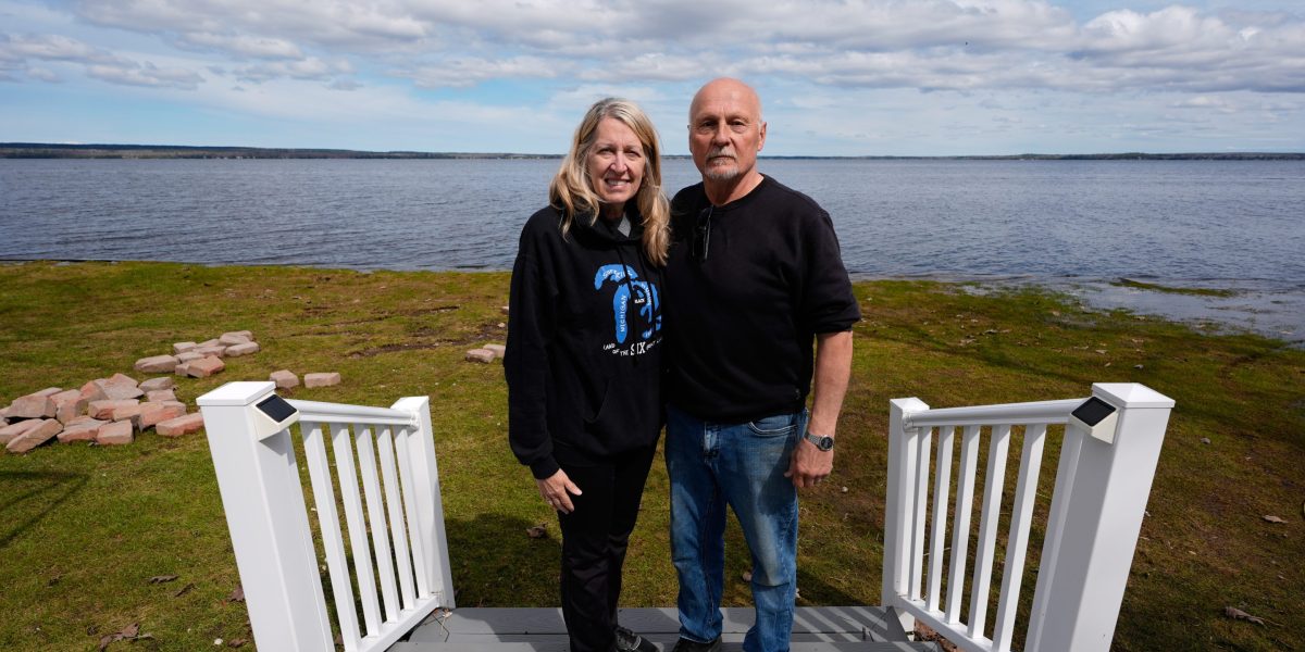
Tom and Diane Peterman said they tried to buy flood insurance after moving 14 years ago to a retirement home on Black Lake, but were told it was not available, AP reported. John Solum said his family received similar guidance when it bought a 1940s cabin on the lake.
The April flooding followed record March snowfall and record April rainfall across northern Michigan, AP reported. Dozens of counties were placed under a state of emergency as water damaged homes, threatened dams and washed out roads.
At Black Lake, high water pushed broken ice into shorefront properties, damaging decks and breaking windows, according to AP. Solum said floodwater rose to knee height in his home, forcing the family to remove flooring, drywall, furniture, bedding and appliances.
Mapping gaps in rural areas
The Federal Emergency Management Agency creates flood plain maps that help determine where homeowners are required to buy flood insurance and help communities plan for flood hazards, AP reported. But FEMA has not mapped some less-populated areas, including parts of Michigan hit by this year’s flooding.
Black Lake spans Cheboygan and Presque Isle counties. AP reported that Cheboygan has a FEMA flood plain map from 2012, while most areas in Presque Isle have not been mapped.
FEMA told AP in a statement that 95% of the U.S. population lives in mapped areas and described its maps as “snapshots in time.” The agency declined AP’s interview request and did not answer questions about whether this year’s flooding would speed mapping in less-populated places or change its mapping methods.
Chad Berginnis, executive director of the Association of State Floodplain Managers, told AP that FEMA has worked to update older maps but has made limited progress mapping new rural areas despite a 2012 congressional mandate. His group estimates full national mapping would cost $4 billion to $12 billion, AP reported.
FEMA lost close to 20% of its workforce in 2025, according to a Government Accountability Office report cited by AP. Christopher Currie, who audits FEMA for the GAO, told AP the agency had been understaffed before those losses and may have to shift staff from programs such as mapping when responding to multiple disasters.
Rainfall risk outside flood plains
Experts told AP that FEMA’s flood maps focus on rivers, streams and other waterways leaving their banks. They do not account for flooding caused only by heavy rainfall that overwhelms drainage systems or pools in rural areas.
First Street, a company that studies climate-related financial risk, told AP that its models found more than twice as many U.S. properties at significant flood risk after adding rainfall data and mapping the whole country, including smaller streams FEMA does not include. In Michigan, First Street found four times as many properties at risk, according to AP.
Jeremy Porter, First Street’s chief economist, told AP that federal maps miss a source of flooding. The GAO warned five years ago that FEMA flood hazard maps did not reflect the best available climate science or heavy rainfall, AP reported.
Michigan’s National Flood Insurance Program coordinator, Matthew Occhipinti, told AP this spring’s flooding exceeded a 100-year flood level in many areas. University of Michigan climate scientist Richard Rood told AP that a warmer atmosphere and an unusually warm Gulf of Mexico helped set up the heavy snow and rain that hit the upper Midwest.
Homeowners also can face barriers even where communities participate in the National Flood Insurance Program, AP reported. Diane Peterman said she tried three times to buy coverage and was told she was not in a flood zone, though she later learned a neighbor had insurance.
Occhipinti told AP that an average Michigan flood policy costs about $1,000 for $250,000 in coverage, with prices varying by home value and location. Berginnis told AP that FEMA maps should be a starting point for understanding flood risk, not the final answer.
This story draws on original reporting from Fortune.